Lausanne Accessibility: Hills, the m2 Metro, and Getting Around Easily
Is Lausanne easy to get around if walking on slopes is difficult?
Lausanne is built on steep hills between the lake and the upper town, considerably steeper than flat lakeside Geneva, so walking is not always practical. The m2 metro line, Switzerland's only fully automated rack-assisted metro, climbs the steepest sections and is generally accessible, making it the practical way to cover Lausanne's elevation changes.
Why Lausanne is different from flat, lakeside Geneva
Visitors arriving from Geneva often expect Lausanne to feel similar: another Swiss city on the shore of Lake Geneva, an hour away by train. The lake is the same, but the terrain is not. Geneva’s old town sits on a gentle rise above largely level lakefront promenades, and most of the classic walking routes — along the water, through the Jet d’Eau district, out to the international quarter — stay close to flat ground. Lausanne, by contrast, is built across a genuine series of hills: the lakeside district of Ouchy sits at the bottom, the historic centre and cathedral occupy a middle terrace, and the main railway station and upper neighbourhoods sit higher still, with a cumulative elevation change that runs well over 100 metres between the water and the top of the city.
That difference matters for anyone planning a visit around limited mobility, a stroller, heavy luggage, or simply a preference not to spend a day climbing streets. This page sets out what actually works in Lausanne, and it does not promise that the city can be made as flat as Geneva’s lakefront — it cannot. What it can offer is a working method: understanding where the slopes are, and using Lausanne’s m2 metro to do the climbing so pedestrians do not have to.
The m2: Switzerland’s only rack-assisted automated metro
Lausanne’s public transport system includes a piece of infrastructure built specifically to solve this terrain problem: the m2 line. It is a fully automated metro — no driver — and it is the only line on the Swiss network to use rack-and-pinion assistance on its steepest sections, a technology normally associated with mountain railways rather than city metros. The m2 runs roughly north-south through the city, linking the lakeside terminus at Ouchy with Lausanne’s main railway station partway up the hill, and continuing further uphill to Croisettes at the edge of the upper town.
For a visitor deciding how to get from the lake to the centre, or from the station down to a lakeside restaurant or the Olympic Museum area near Ouchy, the m2 is generally the right answer, not the pavement. It is generally accessible, with lifts at stations along the route, and it removes the single biggest physical obstacle in Lausanne: the climb between water level and the upper city. Trains run frequently, and the ride between the lake and the station takes only a few minutes.
That said, “generally accessible” is not the same as “always guaranteed.” Lift maintenance closures happen on any metro system, and a traveller who specifically needs step-free access should check current status before relying on a particular station, rather than assuming every lift will be working on the day of the visit. This is a sensible habit anywhere, but it carries more weight in Lausanne than in flat Geneva, where a lift outage at one point can usually be worked around on foot without much difficulty — in Lausanne, working around a m2 lift outage on foot can mean a genuinely steep, sustained climb.
What the m2 does not solve
It would be convenient to say the m2 covers Lausanne’s accessibility challenges end to end, but that is not accurate, and this page is not going to promise it. The m2 runs along one corridor — essentially a straight line between the lake and the upper town. Lausanne’s old town, its historic core around the cathedral, and many of the streets that branch off the main spine sit on their own slopes, away from any metro station. Getting from an m2 stop to a specific address in the old town, or between two points that are not both near the line, can still mean walking uphill or downhill on a genuinely steep street, sometimes with uneven cobbles underfoot.
In practice, this means treating the m2 as the backbone of a Lausanne visit rather than a complete substitute for walking. A workable approach is to use the metro for the long vertical distances — lake to station, station to upper town — and to plan the remaining short connections deliberately, checking gradient on a map or with a local before setting out, rather than assuming a route will be manageable because it looks short. A five-minute walk in Lausanne can be considerably more strenuous than a five-minute walk in Geneva, purely because of the incline, and that gap is the single most important thing to plan around.
Buses operated by TL, Lausanne’s local transport authority and part of the same Unireso network used in Geneva, supplement the metro and generally use low-floor vehicles, but bus routes on the steepest residential streets still involve real gradient even once passengers are off the vehicle. Older parts of the network and some older buildings and shopfronts along the hillside — a reasonable expectation in a city with this much historic fabric on a slope — are not uniformly adapted, so accessibility is good in the core corridor served by the m2 and more variable elsewhere.
Planning a visit: lake, centre, and station as three levels
It helps to think of central Lausanne as three distinct levels connected by the m2, rather than as one continuous area to wander on foot.
Ouchy, at the bottom, sits directly on the lakeshore, with promenades, the harbour, and boat departures — including Lake Geneva cruises that reach Vevey, Montreux, and across to the French shore near Évian-les-Bains. This level is essentially flat, similar in character to Geneva’s own lakefront, and is comfortable on foot once reached.
The historic centre, in the middle, holds Lausanne Cathedral, the old town streets, and most of the city’s museums and shopping. This is where the terrain becomes noticeable — narrow, sloped streets, some with stairs — and where planning a route in advance, rather than improvising, pays off.
The railway station and upper neighbourhoods, at the top, are where most visitors arrive by train from Geneva or elsewhere, and where the m2 line continues further uphill toward Croisettes.
Moving between these three levels is exactly what the m2 is built for. A typical accessible-minded day might arrive at the station, take the m2 down to Ouchy first while energy is highest, explore the flat lakeside area, then take the m2 back up rather than attempting the climb on foot, before a shorter, carefully chosen walk into the old town if the terrain there is manageable for the individual traveller.
Practical Swiss essentials that also apply in Lausanne
Some practical information carries over from anywhere in Switzerland, including Geneva, and is worth repeating here rather than assuming it is already known.
Emergency numbers: dial 112 for the general emergency line, 144 specifically for ambulance and medical emergencies, and 117 for police. These work from any phone, including a foreign mobile without a local SIM, and Lausanne’s emergency services operate primarily in French, the local language.
Power sockets: Switzerland uses the type J plug, a recessed three-pin socket that differs from the two-pin sockets common elsewhere in Europe. Two-pin type C plugs generally fit into type J sockets, but wider grounded plugs may not without an adapter — worth checking in advance for anyone travelling with medical devices, mobility aid chargers, or other equipment that needs a reliable power connection.
Currency and cost: as in the rest of Switzerland, prices in Lausanne are in Swiss francs (CHF), not euros, and Lausanne shares Geneva’s reputation as an expensive city. Accessible taxis and adapted transport, where needed, should be budgeted for at Swiss rates rather than the lower prices typical just across the French border.
Language: Lausanne, like Geneva, is in French-speaking Switzerland. Staff at transport information points, hotels, and major attractions generally speak English as well, but signage on the street and on transport systems is in French.
When a guided option makes more sense than self-directed walking
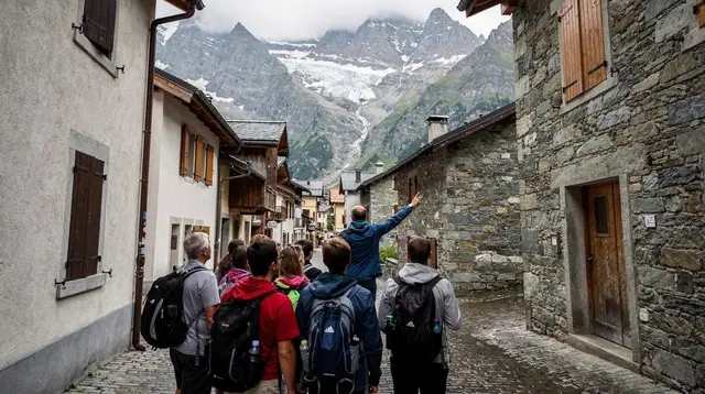
For visitors who want to see Lausanne’s old town and cathedral area without independently navigating the slopes and working out which streets to avoid, a guided tour can remove much of the planning burden, since a local guide already knows which routes minimise steep sections and can adapt pace on the day. A private guided walking tour of Lausanne can be tailored to a specific pace and route, which is often more useful here than in flatter cities, precisely because Lausanne’s terrain varies so much block to block. For a more structured introduction to the main sights, a guided walk through Lausanne’s old town covers the cathedral and historic core with a guide managing the route.
Visitors who would rather see Lausanne from the water than from its hillside streets can also consider a three-hour cruise along the Riviera and Lavaux coastline departing from Ouchy — a way to take in the lakeside towns and the terraced vineyards of Lavaux without any climbing at all. For a broader overview of the city’s layout before deciding how much walking to plan, a photogenic city tour of Lausanne typically covers the main viewpoints across the different levels of the city in a single organised outing.
Luggage, strollers, and wheeled equipment on Lausanne’s slopes
Lausanne’s terrain affects more than travellers with mobility restrictions. Anyone arriving with a rolling suitcase, a stroller, or other wheeled equipment should factor the hills into their route the same way, since a wheeled bag that is effortless on flat ground becomes a real burden on a sustained incline, whether being pulled uphill or braked downhill. The same logic that applies to accessibility planning applies here: use the m2 for the vertical distance rather than wheeling luggage down (or up) a steep street between the station and Ouchy.
Travellers connecting onward by train after a stay in Lausanne, or arriving directly from Geneva Airport, benefit from the same principle in reverse — the station sits at the top of the city, so a hotel near Ouchy or the lakeside means a metro ride with luggage rather than a climb. Lausanne’s railway station is a major hub on the line between Geneva and the rest of Switzerland, and it connects directly to the m2 platforms, so the transition from train to metro does not require navigating stairs to street level and back down again.
Parents travelling with a stroller face a similar calculation to wheelchair users: the m2 removes the need to push a stroller up or down Lausanne’s steepest connecting streets, and stations along the line are generally equipped with lifts rather than stairs-only access. As with any accessibility need, checking that a specific lift is in service before relying on it for a stroller-only route is worth the extra few minutes, particularly if the plan depends on a single station to complete a connection.
Getting to Lausanne from Geneva
Most visitors reading this guide are approaching Lausanne as a day trip from Geneva or as a stop on a longer tour of the Lake Geneva shore. The train connection between the two cities is direct and frequent, arriving at Lausanne’s railway station — the upper level of the three described above — which puts new arrivals at the top of the hill rather than the bottom. This is worth knowing in advance: a traveller stepping off the train and heading straight for the lakeside is starting at the highest point in the city, and the m2 down to Ouchy is the practical way to cover that distance rather than walking down through the old town with luggage or mobility equipment in tow.
For visitors combining Lausanne with other stops along the lake, the Lavaux vineyard terraces east of the city and Vevey further along the shore both sit on gentler terrain than central Lausanne, closer in character to Geneva’s own lakefront. A day trip itinerary covering Lausanne and Lavaux can be planned around the m2 for the Lausanne portion and flatter lakeside or vineyard paths for the rest, which keeps the most physically demanding section of the day contained to a single, well-served metro ride.
Those planning a longer loop around the lake may also find a private day trip from Lausanne to Vevey, Montreux, and Aigle useful, since travelling by car or organised transport for the onward legs avoids repeating the accessibility planning required in Lausanne itself at each subsequent stop — a private day trip from Lausanne to Vevey, Montreux, and Aigle Castle covers this route with door-to-door transport rather than requiring separate train and bus connections at each town.
Comparing Lausanne and Geneva for accessibility
| Geneva | Lausanne | |
|---|---|---|
| General terrain | Mostly flat lakefront and old town on a gentle rise | Steep hills between lake and upper town |
| Elevation change, lake to centre | Modest | Well over 100 metres |
| Key accessible transit link | Trams and buses on mostly level routes | m2 automated, rack-assisted metro |
| Walking between lake and centre | Generally comfortable on foot | Often strenuous; metro recommended |
| Old town terrain | Gentle slope, walkable | Genuinely steep in places, even near the m2 |
This comparison is a guide, not a guarantee — individual streets and buildings vary within both cities, and mobility needs vary between travellers, so checking specific routes and venues in advance remains worthwhile regardless of which city is on the itinerary.
A realistic day plan built around the m2
For a visitor prioritising manageable terrain, a reasonable structure for a day in Lausanne looks like this: arrive at the railway station, take the m2 down to Ouchy first, spend time on the flat lakeside promenade and around the harbour, consider a lake cruise if extended walking is best minimised, take the m2 back toward the centre, and treat any old-town exploration as a shorter, separately planned segment rather than an extension of the lakeside walk. This keeps the heaviest physical effort — the vertical climb between levels — entirely on the metro, and limits on-foot walking to the flatter or more manageable sections of the city.
Travellers continuing on to other parts of the region after Lausanne, such as Montreux and Château de Chillon along the lake, or inland toward Gruyères, will find those destinations have their own, generally gentler terrain profiles closer to Geneva’s than to central Lausanne’s steepest streets — Lausanne’s hills are a distinctive feature of that city specifically, not a pattern repeated everywhere around the lake.
Accessibility Guide
Verified deep-linked GetYourGuide tours. Book through these links and we earn a small commission at no cost to you.
GetYourGuide does not provide a product photo for this activity — the image shows the meeting point, photographed by us.